Services
Find Water
Find the Best Location for Your Water Well
- Homeowners looking to find the best place to drill a well and maximize their investment
- Homesteaders aiming to optimize their land's water potential for farming, gardening, and livestock
- Land buyers to be confident that the land they are purchasing can produce the water they need
- Well drilling companies aiming to increase their success rate and customer satisfaction
- Builders seeking to minimize construction delays and reduce unpredictable expenses
- Farmers needing a reliable water source for irrigation and livestock operations
- Developers planning subdivisions or commercial projects that require multiple wells
- Landowners preparing for future construction, farming, or increasing resale value
Avoid Water
Avoid Underground Fractures and Unexpected Water During Construction
- Builders needing to avoid costly surprises like underground fractures, caves, or unexpected water during foundation work
- Engineers planning deep footings, retaining walls, or basements, ensuring soil and rock stability
- Contractors installing large poles, towers, or fences requiring safe, dry drilling conditions
- Land developers aiming to prevent delays and minimize construction risks
- Homeowners planning pools or major landscaping projects where subsurface conditions matter
- Utility companies and municipalities installing underground pipelines, cables, or infrastructure
Soil Resistivity
Soil Resistivity Studies for Safer and Smarter Projects
- Engineers and contractors needing soil resistivity data for power stations, substations, and grounding system designs
- Environmental consultants assessing landfills, waste disposal sites, or hazardous material storage areas
- Project managers overseeing industrial developments where spill risks or soil contamination are concerns
- Landowners investigating possible soil contamination before purchasing or developing property
- Companies evaluating chemical infiltration risks that could threaten waterbeds and groundwater sources
- Municipalities conducting environmental impact studies for infrastructure expansion
Mining & Environment
Mining and Environmental Studies for Safer and Smarter Development
- Mining companies needing detailed geological and hydrogeological studies before exploration or excavation
- Environmental consultants conducting site assessments, impact studies, or land restoration projects
- Developers seeking to understand subsurface risks before investing in large-scale projects
- Landowners evaluating the environmental safety and resource potential of their property
- Government agencies requiring site evaluations for compliance, remediation, or conservation efforts
- Engineers planning tunnels, quarries, or earthworks where subsurface stability is critical
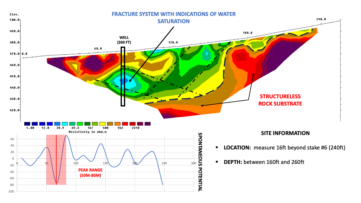
Sample of resistivity imaging
The resistivity image displays a cross-sectional view of the subsurface along a straight line. Low resistivity zones (warmer colors like red and yellow) may indicate moist soil or aquifers, while high resistivity zones (cooler colors like blue and green) often represent rock, dry soil, or impermeable layers.

✅ We are insured!